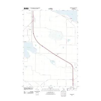
2011 Map of Freedom
USGS Topo · Published 2011About this map
Freedom and Carp Lake anchor this 2011 survey of northern Michigan, where the landscape is defined by its transition from the shores of Lake Huron into a network of interior wetlands and smaller lakes. The infrastructure of the era is clearly visible, from the Mackinaw City Municipal Arpt and Mackinaw Golf Course in the northwest to the major transportation corridor of the interstate cutting diagonally through the township.
Find a feature on this map
41 named features on this map. Tap any name to fly to it.
Don’t see what you’re looking for? This feature index may not catch every label — zoom into the map to look around manually.
Map Details
Editions of this 2011 Freedom Map
This is the sole edition of this map. No revisions or reprints were ever made.
Other maps of this area

1955 · Cheboygan
USGS Topo · 1:250,000

1957 · Mullett Lake
USGS Topo · 1:62,500

1958 · Cheboygan
USGS Topo · 1:250,000

1958 · Pellston
USGS Topo · 1:62,500

1964 · Round Island
USGS Topo · 1:24,000
1964 · St. Ignace
USGS Topo · 1:24,000
1964 · McGulpin Point
USGS Topo · 1:24,000
1982 · Levering
USGS Topo · 1:25,000

1982 · Pellston
USGS Topo · 1:25,000

1982 · Point Nipigon
USGS Topo · 1:25,000