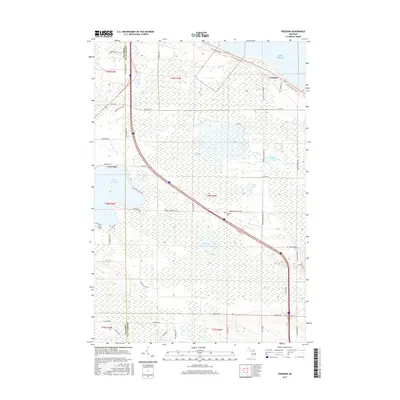
2017 Map of Freedom
USGS Topo · Published 2017About this map
The shore of Lake Huron and the inland waters of northern Michigan define this landscape along the border of Emmet and Cheboygan Counties. The settlement of Freedom sits near the coastline, where the N Central State Trail follows the path of an old rail corridor toward the Straits. This area is characterized by an extensive network of wetlands and small lakes, including Mud Lake, Penny Lake, and Malony Lake, which drain through waterways like Mill Cr and Mud Cr. Further west, the community of Carp Lake borders the large expanse of Lake Paradise, a significant local landmark. The presence of Hebron Cem and the naming of Hebron Town Hall Rd reflect the established local history of the township, while a dense grid of secondary roads such as Hebron Mail Route Rd and Old Mackinaw Rd connects the scattered homesteads and marshes.
Find a feature on this map
56 named features on this map. Tap any name to fly to it.
Don’t see what you’re looking for? This feature index may not catch every label — zoom into the map to look around manually.
Map Details
Editions of this 2017 Freedom Map
This is the sole edition of this map. No revisions or reprints were ever made.
Other maps of this area

1955 · Cheboygan
USGS Topo · 1:250,000

1957 · Mullett Lake
USGS Topo · 1:62,500

1958 · Cheboygan
USGS Topo · 1:250,000

1958 · Pellston
USGS Topo · 1:62,500

1964 · Round Island
USGS Topo · 1:24,000
1964 · St. Ignace
USGS Topo · 1:24,000
1964 · McGulpin Point
USGS Topo · 1:24,000
1982 · Levering
USGS Topo · 1:25,000

1982 · Pellston
USGS Topo · 1:25,000

1982 · Point Nipigon
USGS Topo · 1:25,000