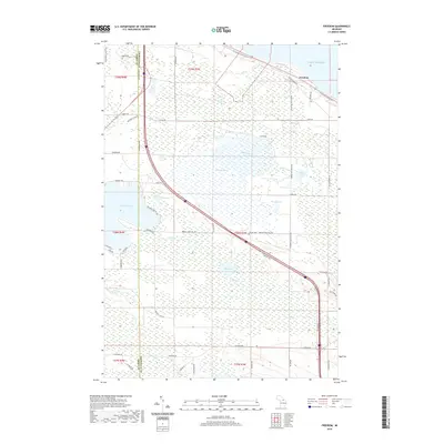
2019 Map of Freedom
USGS Topo · Published 2019About this map
Freedom lies near the shoreline of Lake Huron in this northern Michigan landscape, where the boundary between Emmet County and Cheboygan County bisects a region of extensive wetlands and small inland lakes. The N Central State Trail follows the former rail corridor across the northern edge of the map, passing through the marshlands of Mill Creek. To the south, a network of county roads like Hebron Mail Route Road and Levering Road connects rural homesteads and the Hebron Cemetery. The geography is defined by a series of distinct water bodies including Lake Paradise, Nolten Lake, Sommers Lake, and the expansive Dingman Marsh, illustrating the complex drainage patterns of the Tip of the Mitt before they reach the Great Lakes.
Find a feature on this map
52 named features on this map. Tap any name to fly to it.
Don’t see what you’re looking for? This feature index may not catch every label — zoom into the map to look around manually.
Map Details
Editions of this 2019 Freedom Map
This is the sole edition of this map. No revisions or reprints were ever made.
Other maps of this area

1955 · Cheboygan
USGS Topo · 1:250,000

1957 · Mullett Lake
USGS Topo · 1:62,500

1958 · Cheboygan
USGS Topo · 1:250,000

1958 · Pellston
USGS Topo · 1:62,500

1964 · Round Island
USGS Topo · 1:24,000
1964 · St. Ignace
USGS Topo · 1:24,000
1964 · McGulpin Point
USGS Topo · 1:24,000
1982 · Levering
USGS Topo · 1:25,000

1982 · Pellston
USGS Topo · 1:25,000

1982 · Point Nipigon
USGS Topo · 1:25,000