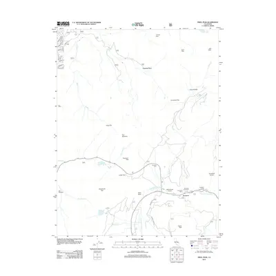
2012 Map of Freel Peak
USGS Topo · Published 2012About this map
Freel Peak and the neighboring summits of Jobs Sister and Trimmer Peak anchor the high-elevation terrain of this region at the start of the twenty-first century. The map highlights a significant transition from the developed residential streets in the northwest, such as Chippewa St and Iroquois Cir, to the protected lands of Hope Valley. A network of high-country routes including Armstrong Pass and Luther Pass connects these mountain basins, serving as vital links between the West Carson Canyon and the surrounding peaks.
Find a feature on this map
46 named features on this map. Tap any name to fly to it.
Don’t see what you’re looking for? This feature index may not catch every label — zoom into the map to look around manually.
Map Details
Editions of this 2012 Freel Peak Map
This is the sole edition of this map. No revisions or reprints were ever made.
Other maps of this area

1889 · Pyramid Peak
USGS Topo · 1:125,000

1889 · Markleeville
USGS Topo · 1:125,000

1891 · Markleeville
USGS Topo · 1:125,000

1891 · Pyramid Peak
USGS Topo · 1:125,000

1893 · Markleeville
USGS Topo · 1:125,000

1895 · Pyramid Peak
USGS Topo · 1:125,000

1896 · Pyramid Peak
USGS Topo · 1:125,000

1947 · Sacramento
USGS Topo · 1:250,000

1948 · Walker Lake
USGS Topo · 1:250,000

1948 · Sacramento
USGS Topo · 1:250,000