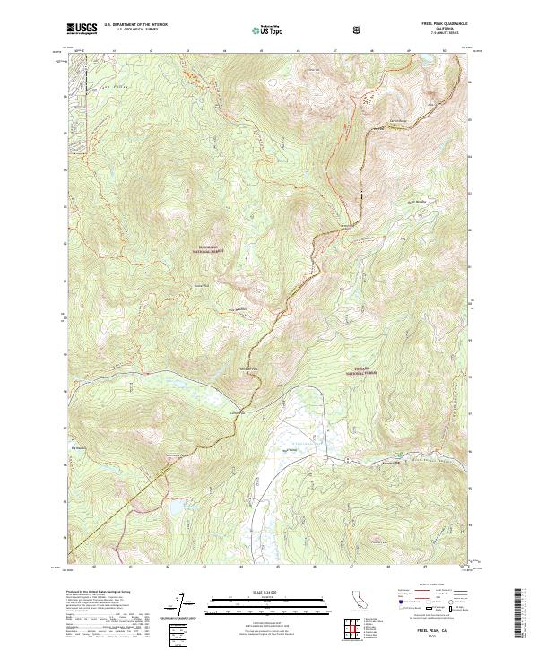
2022 Map of Freel Peak
USGS Topo · Published 2022About this map
Freel Peak and the high ridges of the Carson Range dominate this Sierra Nevada landscape along the boundary of Eldorado National Forest and Toiyabe National Forest. The map documents a complex network of backcountry routes, including the Tahoe Rim Trl and Pioneer Trl, which connect high-altitude landmarks like Armstrong Pass and Luther Pass. In the lower elevations, the settlement of Sorensens sits along the W Fork Carson River as it winds through Hope Valley. The transition from the residential streets of Lake Valley in the northwest, including Elks Club Dr and Pioneer Trl, to the glaciated basins containing Star Lake and Scotts Lake illustrates the stark topography of the El Dorado and Alpine county line. This survey captures the modern state of these protected lands, where historical mountain passes now serve as key junctions for modern recreation and water resource management.
Find a feature on this map
62 named features on this map. Tap any name to fly to it.
Don’t see what you’re looking for? This feature index may not catch every label — zoom into the map to look around manually.
Map Details
Editions of this 2022 Freel Peak Map
This is the sole edition of this map. No revisions or reprints were ever made.
Other maps of this area

1889 · Pyramid Peak
USGS Topo · 1:125,000

1889 · Markleeville
USGS Topo · 1:125,000

1891 · Markleeville
USGS Topo · 1:125,000

1891 · Pyramid Peak
USGS Topo · 1:125,000

1893 · Markleeville
USGS Topo · 1:125,000

1895 · Pyramid Peak
USGS Topo · 1:125,000

1896 · Pyramid Peak
USGS Topo · 1:125,000

1947 · Sacramento
USGS Topo · 1:250,000

1948 · Walker Lake
USGS Topo · 1:250,000

1948 · Sacramento
USGS Topo · 1:250,000