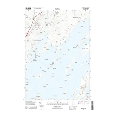
2014 Map of Freeport
USGS Topo · Published 2014About this map
Freeport and its surrounding coastal landings are defined by the intricate shoreline of Casco Bay, where the Harraseeket River and Little River meet the sea. This coastal landscape is dotted with small, family-named settlements like Cushing Briggs and South Freeport, alongside numerous historic burial grounds such as the Old Parish Burying Ground and Porters Landing Cem. The map reveals a maritime-oriented geography where necks of land like Wolf Neck and Flying Point Neck reach into the water, sheltering coves and creating a complex network of island groups including Googins Island, Williams Island, and the more distant Bustins Island. Inland, the terrain rises toward Hedgehog Mountain and Pleasant Hill, while small waterways like Frost Gully Brook and Merrill Brook drain the wooded interior toward the salt water. The concentration of landings—Mast Landing, Porter Landing, and Bunganuc Landing—speaks to the historical importance of boat access for these Cumberland County communities.
Find a feature on this map
189 named features on this map. Tap any name to fly to it.
Don’t see what you’re looking for? This feature index may not catch every label — zoom into the map to look around manually.
Map Details
Editions of this 2014 Freeport Map
This is the sole edition of this map. No revisions or reprints were ever made.
Other maps of this area

1892 · Freeport
USGS Topo · 1:62,500

1893 · Small Point
USGS Topo · 1:62,500

1893 · Casco Bay
USGS Topo · 1:62,500

1894 · Bath
USGS Topo · 1:62,500

1914 · Casco Bay
USGS Topo · 1:48,000

1916 · Casco Bay
USGS Topo · 1:62,500

1916 · Portland And Vicinity
USGS Topo · 1:62,500

1918 · Portland And Vicinity
USGS Topo · 1:62,500

1919 · Small Point
USGS Topo · 1:62,500

1920 · Bath
USGS Topo · 1:62,500