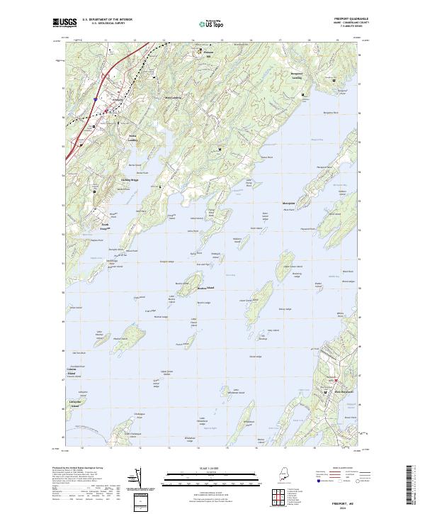
2024 Map of Freeport
USGS Topo · Published 2024About this map
The town of Freeport and its coastal surroundings are defined by a complex network of tidal inlets and islands within Casco Bay. This 2024 survey captures the established landscape of Cumberland County, where the inland settlements of Pleasant Hill and Mast Landing transition into the maritime-focused communities of South Freeport and Porter Landing. The geography is notably intricate, featuring numerous landforms like Merepoint Neck and the Wolf Neck peninsula, which frame the waters of the Harraseeket River and Maquoit Bay. Local history is well-preserved through several family and community burial grounds, including the First Parish Cemetery and the Chase-Jameson Cem located near Bunganuc Landing. Offshore, the map details a scattered archipelago including Whaleboat Island, Lower Goose Island, and The Goslings, illustrating the navigational challenges and natural shelter provided by the fragmented Maine coastline.
Find a feature on this map
192 named features on this map. Tap any name to fly to it.
Don’t see what you’re looking for? This feature index may not catch every label — zoom into the map to look around manually.
Map Details
Editions of this 2024 Freeport Map
This is the sole edition of this map. No revisions or reprints were ever made.
Other maps of this area

1892 · Freeport
USGS Topo · 1:62,500

1893 · Small Point
USGS Topo · 1:62,500

1893 · Casco Bay
USGS Topo · 1:62,500

1894 · Bath
USGS Topo · 1:62,500

1914 · Casco Bay
USGS Topo · 1:48,000

1916 · Casco Bay
USGS Topo · 1:62,500

1916 · Portland And Vicinity
USGS Topo · 1:62,500

1918 · Portland And Vicinity
USGS Topo · 1:62,500

1919 · Small Point
USGS Topo · 1:62,500

1920 · Bath
USGS Topo · 1:62,500