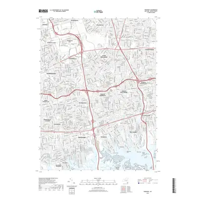
2019 Map of Freeport
USGS Topo · Published 2019About this map
Hofstra University and Nassau Community College anchor the educational landscape of central Nassau County in this 2019 study, situated amidst the dense suburban grid between Garden City and East Meadow. The transition from the tightly packed residential blocks of Uniondale and Roosevelt to the tidal wetlands of East Bay is clearly defined, showing the complex interaction of modern infrastructure with the natural shoreline.
Find a feature on this map
72 named features on this map. Tap any name to fly to it.
Don’t see what you’re looking for? This feature index may not catch every label — zoom into the map to look around manually.
Map Details
Editions of this 2019 Freeport Map
This is the sole edition of this map. No revisions or reprints were ever made.
Other maps of this area

1897 · Hempstead
USGS Topo · 1:62,500

1897 · Oyster Bay
USGS Topo · 1:62,500

1898 · Hempstead
USGS Topo · 1:62,500

1898 · Oyster Bay
USGS Topo · 1:62,500

1899 · Hempstead
USGS Topo · 1:62,500

1900 · Oyster Bay
USGS Topo · 1:62,500

1901 · Babylon
USGS Topo · 1:62,500

1901 · Northport
USGS Topo · 1:62,500

1903 · Babylon
USGS Topo · 1:62,500

1903 · Northport
USGS Topo · 1:62,500