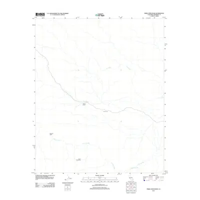
2012 Map of Fried Liver Wash
USGS Topo · Published 2012About this map
Pleasant Valley and the northern slopes of the Hexie Mountains dominate this arid landscape in eastern Riverside County. The drainage network is defined by a series of prominent ephemeral waterways, most notably the Fried Liver Wash and Pinto Wash, which carve through the basin floor. The human imprint on this desert terrain is concentrated along Pinto Basin Rd, which provides access to unique landmarks like the Cholla Garden. The map illustrates a vast, undeveloped area where topography is the primary feature, showcasing the transition from mountain canyons like Wilson Canyon to the broad, flat reaches of Washington Wash. This survey serves as a precise record of the geological and botanical features of the California desert as they existed in the early 21st century.
Find a feature on this map
8 named features on this map. Tap any name to fly to it.
Don’t see what you’re looking for? This feature index may not catch every label — zoom into the map to look around manually.
Map Details
Editions of this 2012 Fried Liver Wash Map
This is the sole edition of this map. No revisions or reprints were ever made.
Other maps of this area

1942 · Amboy
USGS Topo · 1:250,000

1943 · Amboy
USGS Topo · 1:250,000

1943 · Pinkham Well
USGS Topo · 1:62,500

1944 · Pinkham Well
USGS Topo · 1:62,500

1944 · Pinyon Well
USGS Topo · 1:62,500

1947 · Santa Ana
USGS Topo · 1:250,000

1949 · Santa Ana
USGS Topo · 1:250,000

1953 · San Bernardino
USGS Topo · 1:250,000

1954 · Salton Sea
USGS Topo · 1:250,000

1954 · Needles
USGS Topo · 1:250,000