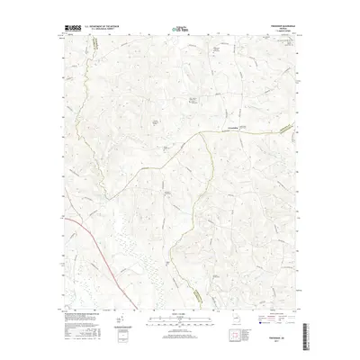
2017 Map of Friendship
USGS Topo · Published 2017About this map
Friendship serves as a central landmark in this 2017 survey of the rural landscape where Hancock, Baldwin, and Washington counties meet. The area is defined by a dense concentration of family burial grounds and historical religious sites, indicating a long-established community structure. Notable locations include the Harmony Churchyard and the Underwood - Harrison Family Cem, alongside several others like the John Thomas Family Cem and Leverett-Sparks Cem. The terrain is deeply carved by a network of waterways including Town Cr, Gumm Cr, and Deepstep Cr, which flow through the wooded hills. Water features such as O'Quinn Pond and Spring Lake dot the landscape, while the local road network, featuring routes like Snyder Rd NE and Indian Trail Rd, connects these scattered homesteads and family landmarks.
Find a feature on this map
70 named features on this map. Tap any name to fly to it.
Don’t see what you’re looking for? This feature index may not catch every label — zoom into the map to look around manually.
Map Details
Editions of this 2017 Friendship Map
This is the sole edition of this map. No revisions or reprints were ever made.
Other maps of this area

1912 · Milledgeville
USGS Topo · 1:62,500

1916 · Irwinton
USGS Topo · 1:62,500

1920 · Irwinton
USGS Topo · 1:62,500

1953 · Athens
USGS Topo · 1:250,000

1957 · Macon
USGS Topo · 1:250,000

1958 · Macon
USGS Topo · 1:250,000

1958 · Athens
USGS Topo · 1:250,000

1959 · Athens
USGS Topo · 1:250,000

1961 · Deepstep
USGS Topo · 1:24,000

1961 · Warthen NW
USGS Topo · 1:24,000