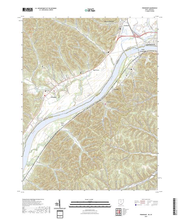
2023 Map of Friendship
USGS Topo · Published 2023About this map
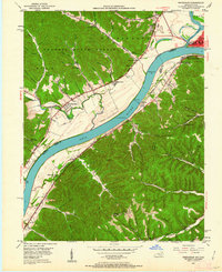
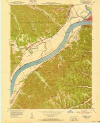
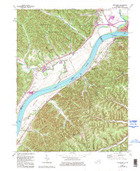
The Ohio River carves a deep valley between the hills of Scioto County, Ohio, and Lewis and Greenup counties in Kentucky. This landscape is defined by the dense network of ridges and hollows that feed into the river, such as Zorns Hollow and Hickory Hollow. Historically significant settlements like Friendship and Firebrick sit along the river's edge, reflecting a period of industrial and residential development tied to the water. In the northeast, the Scioto River joins the Ohio near Portsmouth, where the Scioto County Courthouse stands as a central landmark.
Find a feature on this map
135 named features on this map. Tap any name to fly to it.
Don’t see what you’re looking for? This feature index may not catch every label — zoom into the map to look around manually.
Map Details
Editions of this 2023 Friendship Map
This is the sole edition of this map. No revisions or reprints were ever made.
Historical Maps of Kirkville Through Time
4 maps found