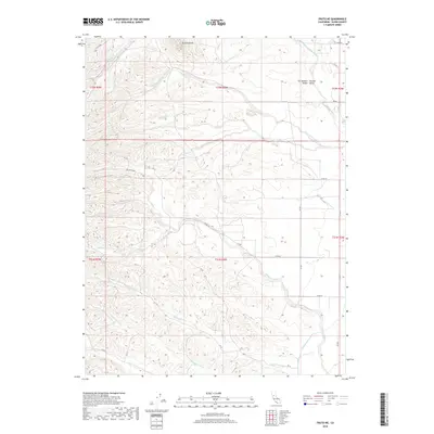
2018 Map of Fruto NE
USGS Topo · Published 2018About this map
Orland Buttes rise above the transition where the foothills meet the Sacramento Valley floor in this section of Glenn County. The landscape is defined by a series of parallel drainage systems, including Hambright Creek and several branches of South Fork Walker Creek, which flow eastward toward the Central Valley. The presence of the Tehama Colusa Canal in the southeastern corner highlights the engineering required to sustain agriculture in this Mediterranean climate, while the naming of seasonal drainages like Tall Cabin Creek and White Cabin Creek suggests early homesteading or grazing activity in the higher ground. A network of county roads, such as Co RD 28 and Co RD C, follows the township and range lines, illustrating the systematic land division that organized this ranching and farming territory.
Find a feature on this map
32 named features on this map. Tap any name to fly to it.
Don’t see what you’re looking for? This feature index may not catch every label — zoom into the map to look around manually.
Map Details
Editions of this 2018 Fruto NE Map
This is the sole edition of this map. No revisions or reprints were ever made.
Other maps of this area

1904 · Vina
USGS Topo · 1:62,500

1904 · Walker Creek
USGS Topo · 1:31,680

1906 · Willows
USGS Topo · 1:62,500

1914 · Kirkwood
USGS Topo · 1:31,680

1914 · Orland
USGS Topo · 1:31,680

1917 · Kurand
USGS Topo · 1:31,680

1917 · Lyman
USGS Topo · 1:31,680

1919 · Fruto
USGS Topo · 1:62,500

1944 · Fruto
USGS Topo · 1:62,500

1944 · Flournoy
USGS Topo · 1:62,500