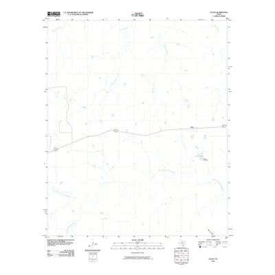
2010 Map of Fulda
USGS Topo · Published 2010About this map
North Fork Little Wichita River meanders across this rural Baylor County landscape, which remains characterized by its network of seasonal drainage creeks and small ranching impoundments. The settlement of Fulda sits along the shared path of Highway 277 82, serving as a primary transit point through this cattle-country terrain. Local water management is evident at Cowan Lake, held by the Cowan Lake Dam in the eastern portion of the survey. Numerous named tributaries, including Mitchell Creek, Timber Creek, and Cottonwood Creek, define the subtle topography, flowing toward the larger river system. Toward the southern boundary, the land drops toward Wolf Hollow and Little Mountain Creek, illustrating the transition from flat prairie to the broken draws typical of north-central Texas.
Find a feature on this map
12 named features on this map. Tap any name to fly to it.
Don’t see what you’re looking for? This feature index may not catch every label — zoom into the map to look around manually.
Map Details
Editions of this 2010 Fulda Map
This is the sole edition of this map. No revisions or reprints were ever made.
Other maps of this area

1932 · Dundee
USGS Topo · 1:62,500

1954 · Wichita Falls
USGS Topo · 1:250,000

1958 · Wichita Falls
USGS Topo · 1:250,000

1963 · Dundee
USGS Topo · 1:24,000

1963 · Dundee SW
USGS Topo · 1:24,000

1966 · Franklin Bend
USGS Topo · 1:24,000

1966 · Fulda
USGS Topo · 1:24,000
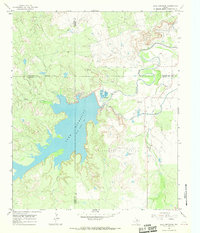
1966 · Lake Diversion
USGS Topo · 1:24,000

1966 · Northeast Lake Kemp
USGS Topo · 1:24,000

1966 · Southeast Lake Kemp
USGS Topo · 1:24,000