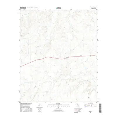
2016 Map of Fulda
USGS Topo · Published 2016About this map
The settlement of Fulda sits along the shared path of Highway 82 and 277 in this 2016 survey of north-central Texas. The landscape is defined by the winding drainage systems of the N Fork Little Wichita River, which carves through the southern half of the quadrangle. Tributaries like Coal Cr and Little Mountain Cr feed into the river valley, while the northern portion of the map is marked by the headwaters of several creeks including Cottonwood Cr and Timber Cr. A distinct terrain feature known as Wolf Hollow is found in the southeast corner near the Baylor-Archer county line, while Cowan Lake provides a notable water catchment area just south of the main highway corridor. The map illustrates a rural Texas environment where transportation routes follow the higher ground between seasonal creek beds.
Find a feature on this map
11 named features on this map. Tap any name to fly to it.
Don’t see what you’re looking for? This feature index may not catch every label — zoom into the map to look around manually.
Map Details
Editions of this 2016 Fulda Map
This is the sole edition of this map. No revisions or reprints were ever made.
Other maps of this area

1932 · Dundee
USGS Topo · 1:62,500

1954 · Wichita Falls
USGS Topo · 1:250,000

1958 · Wichita Falls
USGS Topo · 1:250,000

1963 · Dundee
USGS Topo · 1:24,000

1963 · Dundee SW
USGS Topo · 1:24,000

1966 · Franklin Bend
USGS Topo · 1:24,000

1966 · Fulda
USGS Topo · 1:24,000
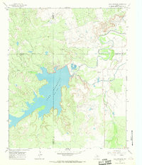
1966 · Lake Diversion
USGS Topo · 1:24,000

1966 · Northeast Lake Kemp
USGS Topo · 1:24,000

1966 · Southeast Lake Kemp
USGS Topo · 1:24,000