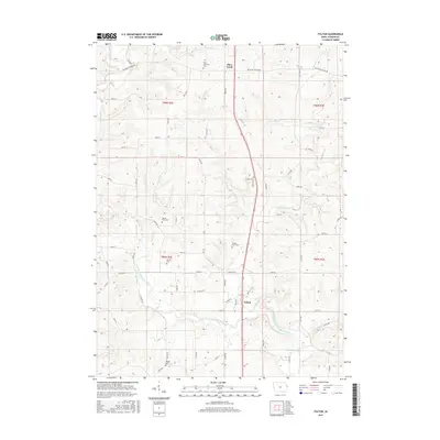
2015 Map of Fulton
USGS Topo · Published 2015About this map
The North Fork Maquoketa River winds through this section of Jackson County, carving a valley that dictates the local road network and settlement patterns. Near the small community of Fulton, the river receives flow from Farmers Cr, while Buck Cr and Torecout Cr drain the surrounding uplands. The landscape is characterized by a series of family and parish burial grounds, including the Saint Lawrence Cem near Otter Creek and several smaller plots like Beedle Farm Cem and Sweezy Cem.
Find a feature on this map
39 named features on this map. Tap any name to fly to it.
Don’t see what you’re looking for? This feature index may not catch every label — zoom into the map to look around manually.
Map Details
Editions of this 2015 Fulton Map
This is the sole edition of this map. No revisions or reprints were ever made.
Other maps of this area

1891 · Maquoketa
USGS Topo · 1:62,500

1891 · Baldwin
USGS Topo · 1:62,500

1901 · Peosta
USGS Topo · 1:125,000

1935 · East Dubuque
USGS Topo · 1:62,500

1940 · East Dubuque
USGS Topo · 1:62,500

1959 · Dubuque
USGS Topo · 1:250,000

1961 · Dubuque
USGS Topo · 1:250,000

1962 · Dubuque
USGS Topo · 1:250,000
1962 · La Motte
USGS Topo · 1:24,000

1962 · Zwingle
USGS Topo · 1:24,000