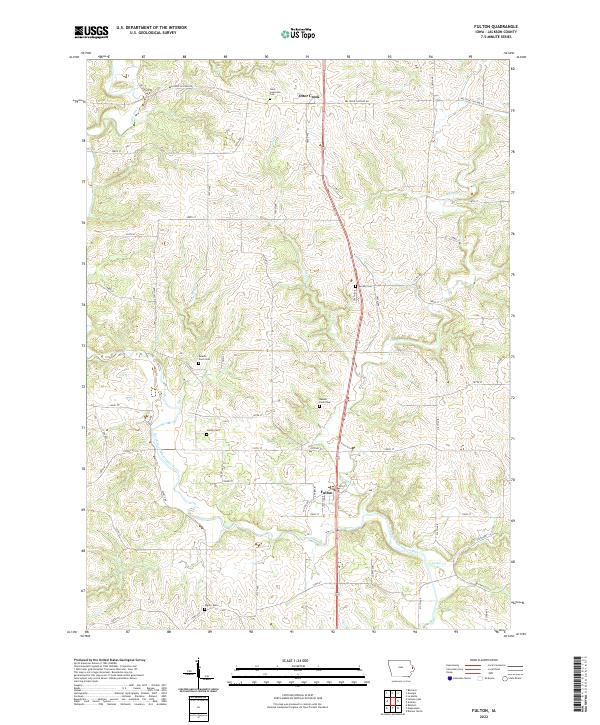
2022 Map of Fulton
USGS Topo · Published 2022About this map
Fulton and Otter Creek serve as the primary nodes of settlement in this part of Jackson County, where the North Fork Maquoketa River carves a winding path through the landscape. The geography is defined by a dense network of tributaries including Lytle Creek, Farmers Cr, and Buck Cr, which likely influenced the original placement of family farms and rural roads. For genealogists, the map is particularly useful for identifying small, specific burial sites often lost to time, such as Beedle Farm Cem, Sweezy Cem, and Sutton Cem. These family-named landmarks, along with Saint Lawrence Cem and Esgate Cem, provide clear spatial anchors for historical research within the townships of t85n r2e and t86n r3e. The road system, from the established Bellevue Cascade Rd to numerous numeric avenues, reflects a late 20th-century rural infrastructure supporting the region's agricultural character.
Find a feature on this map
63 named features on this map. Tap any name to fly to it.
Don’t see what you’re looking for? This feature index may not catch every label — zoom into the map to look around manually.
Map Details
Editions of this 2022 Fulton Map
This is the sole edition of this map. No revisions or reprints were ever made.
Other maps of this area

1891 · Maquoketa
USGS Topo · 1:62,500

1891 · Baldwin
USGS Topo · 1:62,500

1901 · Peosta
USGS Topo · 1:125,000

1935 · East Dubuque
USGS Topo · 1:62,500

1940 · East Dubuque
USGS Topo · 1:62,500

1959 · Dubuque
USGS Topo · 1:250,000

1961 · Dubuque
USGS Topo · 1:250,000

1962 · Dubuque
USGS Topo · 1:250,000
1962 · La Motte
USGS Topo · 1:24,000

1962 · Zwingle
USGS Topo · 1:24,000