2023 Map of Fulton
USGS Topo · Published 2023About this map
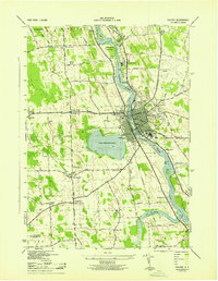
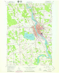
The Oswego River serves as the central artery for this part of Oswego County, where industrial history and natural landscapes converge. The city of Fulton dominates the eastern bank, defined by a dense street grid and significant riverfront development near the CSX railroad corridor. Across the water, Stevenson Beach sits on the shores of Lake Neatahwanta, a prominent recreational feature that contrasts with the surrounding wetlands and smaller water bodies like Lily Creek and Ox Creek.
Find a feature on this map
155 named features on this map. Tap any name to fly to it.
Don’t see what you’re looking for? This feature index may not catch every label — zoom into the map to look around manually.
Map Details
Editions of this 2023 Fulton Map
This is the sole edition of this map. No revisions or reprints were ever made.
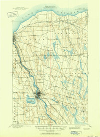
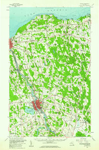
Historical Maps of Ira Through Time
5 maps found