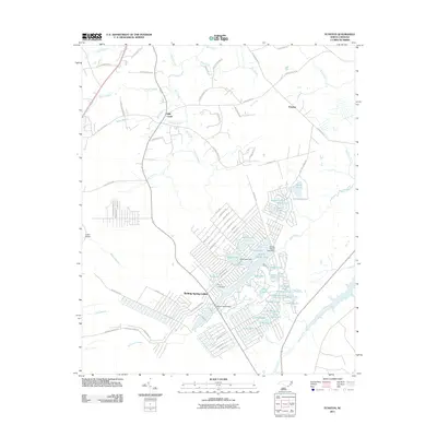
2011 Map of Funston
USGS Topo · Published 2011About this map
Boiling Spring Lakes forms the primary development within this part of Brunswick County, characterized by an extensive network of residential streets and a dense chain of artificial and natural water bodies. The community is built around a series of managed lakes, including Patricia Lake, Spring Lake, and North Lake, many of which are held by structures such as the Boiling Spring Lake Dam. The suburban layout contrasts sharply with the surrounding wetland geography, where the drainages of Half Hell Swamp, Bell Swamp, and Middle Swamp dominate the landscape.
Find a feature on this map
97 named features on this map. Tap any name to fly to it.
Don’t see what you’re looking for? This feature index may not catch every label — zoom into the map to look around manually.
Map Details
Editions of this 2011 Funston Map
This is the sole edition of this map. No revisions or reprints were ever made.
Other maps of this area

1942 · Wilmington
USGS Topo · 1:62,500

1943 · Funston
USGS Topo · 1:24,000

1943 · Winnabow
USGS Topo · 1:24,000

1943 · Bolivia
USGS Topo · 1:24,000

1943 · Lockwoods Folly
USGS Topo · 1:24,000

1943 · Lewis Swamp
USGS Topo · 1:24,000

1944 · Bolivia
USGS Topo · 1:31,680

1944 · Winnabow
USGS Topo · 1:31,680

1944 · Lockwoods Folly
USGS Topo · 1:31,680

1944 · Lewis Swamp
USGS Topo · 1:31,680