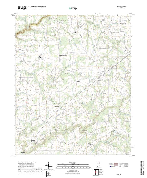
2024 Map of Fyffe
USGS Topo · Published 2024About this map
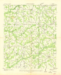
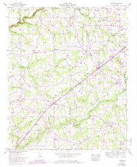
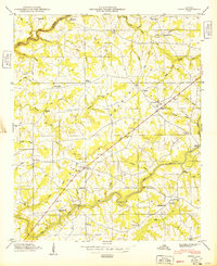
Sand Mountain dominates this portion of DeKalb County, where the high plateau landscape is defined by the headwaters of numerous creeks including South Sauty Creek and Town Creek. The area maintains a rural, agricultural character with several small communities and crossroads such as Moores Crossroads and Gibson Crossroads serving as local anchors. Family history and local heritage are well-documented through a dense concentration of cemeteries and churches, ranging from Zion Hill Baptist Church Cem in the north to the Lusk Chapel Cem near McKestes. The map also captures several private water bodies like Chitwoods Lake and Fletcher Gilberts Lake, alongside named geographical points such as Horseshoe Bend. This documentation reflects the long-standing settlement patterns of the Fyffe and Geraldine area, where local roads still follow the ridges and valleys of the plateau.
Find a feature on this map
170 named features on this map. Tap any name to fly to it.
Don’t see what you’re looking for? This feature index may not catch every label — zoom into the map to look around manually.
Map Details
Editions of this 2024 Fyffe Map
This is the sole edition of this map. No revisions or reprints were ever made.
Historical Maps of Moores Crossroads Through Time
4 maps found