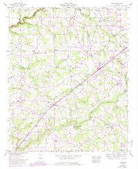
1946 Map of Fyffe
USGS Topo · Published 1983About this map
Fyffe and Rainsville anchor this 1946 topographic survey, which highlights the agricultural and social fabric of the Sand Mountain plateau. The landscape is defined by the headwaters of South Sauty Creek and Town Creek, with early rural road networks connecting numerous local landmarks like Moores Crossroads and Gibson Crossroads. This map captures a particular moment in DeKalb County history, showing the distribution of family-named churches and community centers before the expansion of modern infrastructure. Researchers can trace historic properties near Warren Cem and Nazareth Ch, or locate traditional water crossings such as Guest Bridge and Lawson Ford. The detailed purple photorevisions from 1981 reveal several decades of change, including the evolving corporate boundaries and new woodland growth, providing a rare layered look at how this Alabama upland region transitioned from a collection of dispersed settlements into defined townships.
Find a feature on this map
66 named features on this map. Tap any name to fly to it.
Don’t see what you’re looking for? This feature index may not catch every label — zoom into the map to look around manually.
Map Details
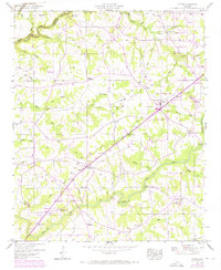
Editions of this 1946 Fyffe Map
2 editions found
Other maps of this area

1885 · Gadsden
USGS Topo · 1:125,000

1886 · Stevenson
USGS Topo · 1:125,000

1888 · Gadsden
USGS Topo · 1:125,000

1888 · Scottsboro
USGS Topo · 1:125,000

1892 · Scottsboro
USGS Topo · 1:125,000

1892 · Stevenson
USGS Topo · 1:125,000

1892 · Gadsden
USGS Topo · 1:125,000

1893 · Fort Payne
USGS Topo · 1:125,000

1895 · Stevenson
USGS Topo · 1:125,000

1895 · Gadsden
USGS Topo · 1:125,000