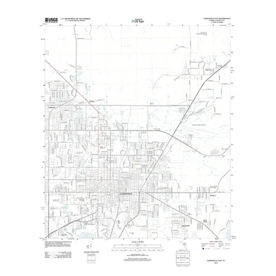
2012 Map of Gainesville East
USGS Topo · Published 2012About this map
The Gainesville city center and the sprawling campus of the University of Florida anchor this 2012 study of Alachua County. The map details a landscape where institutional grounds meet expanding residential neighborhoods like Northwood and Paradise. Significant water features define the southern and eastern edges of the urban area, including the Lake Alice conservation area on campus and the expansive Bivans Arm, which sits just west of Kincaid Hills. The presence of the University of Florida Beef Research Unit to the north and the College of Veterinary Medicine highlights the city's role as a major academic and research hub.
Find a feature on this map
126 named features on this map. Tap any name to fly to it.
Don’t see what you’re looking for? This feature index may not catch every label — zoom into the map to look around manually.
Map Details
Editions of this 2012 Gainesville East Map
This is the sole edition of this map. No revisions or reprints were ever made.
Other maps of this area

1890 · Arredondo
USGS Topo · 1:62,500

1892 · Arredondo
USGS Topo · 1:62,500

1894 · Arredondo
USGS Topo · 1:62,500

1938 · Hawthorn
USGS Topo · 1:48,000

1941 · Starke
USGS Topo · 1:62,500

1943 · Hawthorn
USGS Topo · 1:62,500

1948 · Starke
USGS Topo · 1:50,000

1949 · Waldo
USGS Topo · 1:24,000

1949 · Starke
USGS Topo · 1:62,500

1954 · Gainesville
USGS Topo · 1:250,000