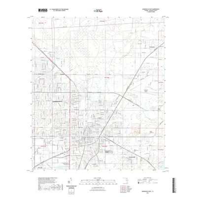
2021 Map of Gainesville East
USGS Topo · Published 2021About this map
The University of Florida and its surrounding urban expansion dominate the southwestern portion of this Alachua County study. The map illustrates the transition from the city center of Gainesville to the low-lying wetlands and preserves that define the eastern landscape. To the north and east, the terrain becomes increasingly dominated by water and forest, including the vast Gum Root Swamp and the edge of Newnans Lake. Several established communities and neighborhoods, such as Lincoln Estates, Kincaid Hills, and Fairbanks, are positioned between the city's built-up core and the expansive natural corridors of Hatchet Creek and Little Hatchet Creek. Researchers will find a high density of cemeteries and memorial sites, such as Evergreen Cem and Forest Meadows Cem East, alongside civic landmarks like the Alachua County Criminal Justice Center. The presence of the Morningside Nature Center Trl highlights the area's commitment to preserving its ecological character amidst ongoing regional growth.
Find a feature on this map
154 named features on this map. Tap any name to fly to it.
Don’t see what you’re looking for? This feature index may not catch every label — zoom into the map to look around manually.
Map Details
Editions of this 2021 Gainesville East Map
This is the sole edition of this map. No revisions or reprints were ever made.
Other maps of this area

1890 · Arredondo
USGS Topo · 1:62,500

1892 · Arredondo
USGS Topo · 1:62,500

1894 · Arredondo
USGS Topo · 1:62,500

1938 · Hawthorn
USGS Topo · 1:48,000

1941 · Starke
USGS Topo · 1:62,500

1943 · Hawthorn
USGS Topo · 1:62,500

1948 · Starke
USGS Topo · 1:50,000

1949 · Waldo
USGS Topo · 1:24,000

1949 · Starke
USGS Topo · 1:62,500

1954 · Gainesville
USGS Topo · 1:250,000