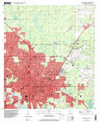
1994 Map of Gainesville East
USGS Topo · Published 2000About this map
The University of Florida campus and the eastern portions of Gainesville dominate this 1994 survey, illustrating a landscape defined by significant public institutions and natural boundaries. The dense grid of the city, including neighborhoods like Northwood, Lincoln Estates, and Kincaid Hills, is bounded to the east by the wetlands of Newnans Lake and to the north by the mixed terrain of Buck Bay and Potato Patch Bay. Large-scale facilities such as the Sunland Training Center (State Hospital) and the Gainesville Regional Airport occupy the urban periphery, while the southern edge meets the northern reaches of the Paynes Prairie State Preserve. This era captures the city's growth along University Avenue and the CSX Transportation rail line, showing the proximity of quiet local landmarks like the Mize Cem Missionary Ch to the expanding municipal infrastructure.
Find a feature on this map
103 named features on this map. Tap any name to fly to it.
Don’t see what you’re looking for? This feature index may not catch every label — zoom into the map to look around manually.
Map Details
Editions of this 1994 Gainesville East Map
This is the sole edition of this map. No revisions or reprints were ever made.
Other maps of this area

1890 · Arredondo
USGS Topo · 1:62,500

1892 · Arredondo
USGS Topo · 1:62,500

1894 · Arredondo
USGS Topo · 1:62,500

1938 · Hawthorn
USGS Topo · 1:48,000

1941 · Starke
USGS Topo · 1:62,500

1943 · Hawthorn
USGS Topo · 1:62,500

1948 · Starke
USGS Topo · 1:50,000

1949 · Waldo
USGS Topo · 1:24,000

1949 · Starke
USGS Topo · 1:62,500

1954 · Gainesville
USGS Topo · 1:250,000