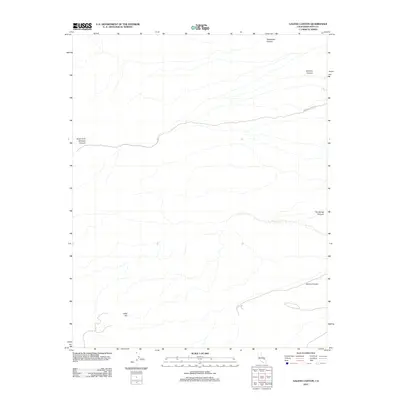
2012 Map of Galena Canyon
USGS Topo · Published 2012About this map
Galena Canyon and several neighboring desert drainages define this Inyo County landscape during the early 2010s. This survey focuses on the arid, high-relief terrain where steep watercourses like Starvation Canyon and Six Spring Canyon have carved distinct paths through the earth. The map provides a detailed view of the natural topography, highlighting landmarks such as Gold Hill and the complex branching of South Fork Johnson Canyon. Human impact on the land is minimal and centered on transportation, with Johnson Canyon Rd serving as the primary access point through Johnson Canyon. This specific era of topographic mapping by the U.S. Geological Survey captures the interplay between the drainage networks and the named desert peaks, offering researchers a clear view of the land's natural geometry before further environmental shifts.
Find a feature on this map
7 named features on this map. Tap any name to fly to it.
Don’t see what you’re looking for? This feature index may not catch every label — zoom into the map to look around manually.
Map Details
Editions of this 2012 Galena Canyon Map
This is the sole edition of this map. No revisions or reprints were ever made.
Other maps of this area

1908 · Furnace Creek
USGS Topo · 1:250,000

1908 · Ballarat
USGS Topo · 1:250,000

1910 · Furnace Creek
USGS Topo · 1:250,000

1913 · Ballarat
USGS Topo · 1:250,000

1915 · Searles Lake
USGS Topo · 1:250,000

1933 · Avawatz Mountains
USGS Topo · 1:250,000

1947 · Trona
USGS Topo · 1:250,000

1948 · Trona
USGS Topo · 1:250,000

1948 · Death Valley
USGS Topo · 1:250,000

1950 · Manly Peak
USGS Topo · 1:62,500