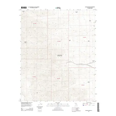
2015 Map of Galena Canyon
USGS Topo · Published 2015About this map
Death Valley National Park encompasses the stark, high-altitude terrain of the Panamint Range as it descends into the arid basins of the Mojave Desert. This 2015 survey captures a landscape defined by dramatic elevation changes, from the prominent heights of Gold Hill to the deeply carved drainage of Galena Canyon. The area is marked by a series of steep eastern slopes where Johnson Canyon and its South Fork cut through the mountains toward the floor of Death Valley. Further north, Starvation Canyon and Six Spring Canyon provide additional topographical detail for those studying the geological structure and water drainage patterns of this protected wilderness. The map is primarily an environmental record, documenting the township and range boundaries that overlay this protected federal land.
Find a feature on this map
16 named features on this map. Tap any name to fly to it.
Don’t see what you’re looking for? This feature index may not catch every label — zoom into the map to look around manually.
Map Details
Editions of this 2015 Galena Canyon Map
This is the sole edition of this map. No revisions or reprints were ever made.
Other maps of this area

1908 · Furnace Creek
USGS Topo · 1:250,000

1908 · Ballarat
USGS Topo · 1:250,000

1910 · Furnace Creek
USGS Topo · 1:250,000

1913 · Ballarat
USGS Topo · 1:250,000

1915 · Searles Lake
USGS Topo · 1:250,000

1933 · Avawatz Mountains
USGS Topo · 1:250,000

1947 · Trona
USGS Topo · 1:250,000

1948 · Trona
USGS Topo · 1:250,000

1948 · Death Valley
USGS Topo · 1:250,000

1950 · Manly Peak
USGS Topo · 1:62,500