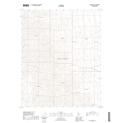
2018 Map of Galena Canyon
USGS Topo · Published 2018About this map
Death Valley National Park encompasses this high-elevation desert landscape, where steep topography transitions from the peaks around Gold Hill down toward the floor of Death Valley. The drainages of Galena Canyon, Johnson Canyon, and Starvation Canyon carve deep paths through the Panamint Range, illustrating the complex hydrological systems that define this part of the Mojave Desert. This 2018 survey detail provides a modern look at the public land survey system and topographic contours of the Inyo County wilderness, tracing the natural boundaries of Six Spring Canyon and South Fork Johnson Canyon. The map is particularly useful for geologists and wilderness travelers seeking to understand the literal lay of the land within this protected expanse of the American West.
Find a feature on this map
15 named features on this map. Tap any name to fly to it.
Don’t see what you’re looking for? This feature index may not catch every label — zoom into the map to look around manually.
Map Details
Editions of this 2018 Galena Canyon Map
This is the sole edition of this map. No revisions or reprints were ever made.
Other maps of this area

1908 · Furnace Creek
USGS Topo · 1:250,000

1908 · Ballarat
USGS Topo · 1:250,000

1910 · Furnace Creek
USGS Topo · 1:250,000

1913 · Ballarat
USGS Topo · 1:250,000

1915 · Searles Lake
USGS Topo · 1:250,000

1933 · Avawatz Mountains
USGS Topo · 1:250,000

1947 · Trona
USGS Topo · 1:250,000

1948 · Trona
USGS Topo · 1:250,000

1948 · Death Valley
USGS Topo · 1:250,000

1950 · Manly Peak
USGS Topo · 1:62,500