
1946 Map of Galice
USGS Topo · Published 1955About this map
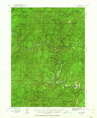
The Siskiyou National Forest landscape shown here in 1946 is defined by a dense concentration of mining sites and remote river camps. Along the winding Rogue River, the small settlement of Galice stands near several significant historic operations, including the Old Channel Mine and Almeda Mine. The map documents a transition in land use from primary resource extraction to forest management and recreation, evidenced by the presence of the Rand Ranger Station and fire observation points like Peavine Lookout. The terrain is marked by steep canyons and prominent peaks such as Mt Peavine and Buckhorn Mtn, with the river serving as the central artery for the region's camps and shelters. Remote outposts like Black Bar and Slate Slide Shelter illustrate the interior's character before modern road development transformed access to the Rogue's deeper reaches.
Find a feature on this map
117 named features on this map. Tap any name to fly to it.
Don’t see what you’re looking for? This feature index may not catch every label — zoom into the map to look around manually.
Map Details
Editions of this 1946 Galice Map
4 editions found
Other maps of this area

1904 · Riddle
USGS Topo · 1:125,000

1908 · Grants Pass
USGS Topo · 1:125,000

1917 · Kerby
USGS Topo · 1:125,000

1918 · Kerby
USGS Topo · 1:125,000

1945 · Kerby
USGS Topo · 1:125,000

1946 · Dutchman Butte
USGS Topo · 1:62,500

1948 · Galice
USGS Topo · 1:62,500

1948 · Dutchman Butte
USGS Topo · 1:62,500

1954 · Bone Mountain
USGS Topo · 1:62,500

1954 · Marial
USGS Topo · 1:62,500