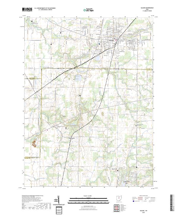
2023 Map of Galion
USGS Topo · Published 2023About this map
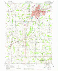
Galion serves as the primary municipal hub in this northern Ohio landscape, where the headwaters of the Olentangy River and several tributaries like Rocky Fork carve through the agricultural plains. The map details a sophisticated network of township and county roads connecting established settlements such as Iberia and Saint James to larger centers. For those tracing local heritage, the area is notably dense with small family and community burial grounds, including the Pletcher Cem, Zoar Cem, and the German Evangelical Lutheran Cem.
Find a feature on this map
156 named features on this map. Tap any name to fly to it.
Don’t see what you’re looking for? This feature index may not catch every label — zoom into the map to look around manually.
Map Details
Editions of this 2023 Galion Map
This is the sole edition of this map. No revisions or reprints were ever made.