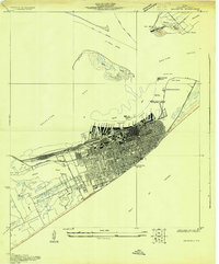
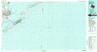
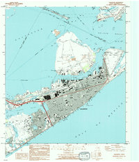
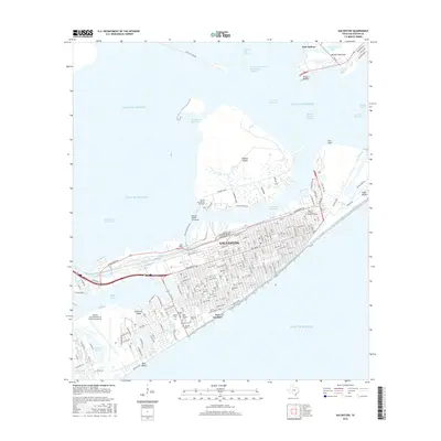
1930 Map of Galveston
USGS Topo · Published 1930About this map
Galveston Island stands as a bustling maritime and rail hub in the early 1930s, defined by its dense grid of streets protected by the Seawall and the Boulevard. The northern waterfront is a complex of industrial infrastructure, featuring a long row of numbered piers from Pier 8 to Pier 41 and the Dry Dock facility along the Pelican Channel. The convergence of the Southern Pacific, G H & S A, and G C & S F railroads at Union Station underscores the city's role as a primary gateway for Texas commerce. On the eastern tip of the island and across Bolivar Roads at Port Bolivar, a network of federal and state facilities including the Quarantine Station, Immigrant Station, and Fort Travis manage the flow of people and defense at the entrance to Galveston Bay.
Find a feature on this map
55 named features on this map. Tap any name to fly to it.
Don’t see what you’re looking for? This feature index may not catch every label — zoom into the map to look around manually.
Map Details
Editions of this 1930 Galveston Map
This is the sole edition of this map. No revisions or reprints were ever made.
Historical Maps of Galveston Through Time
12 maps found
1930 Galveston
Galveston County, TX
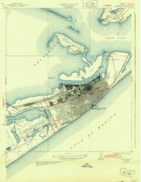
1933 Galveston
Galveston County, TX
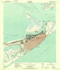
1943 Galveston
Galveston County, TX
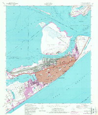
1954 Galveston
Galveston County, TX
1983 Galveston
Galveston County, TX
1994 Galveston
Galveston County, TX
2010 Galveston
Galveston County, TX
2013 Galveston
Galveston County, TX
2016 Galveston
Galveston County, TX
2019 Galveston
Galveston County, TX
2022 Galveston
Galveston County, TX

2025 Galveston
Galveston County, TX