2022 Map of Galveston
USGS Topo · Published 2022About this map
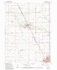
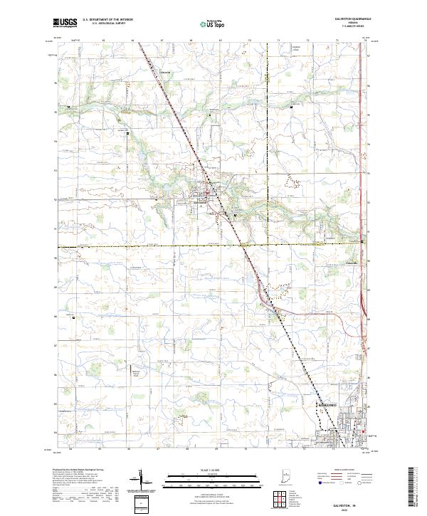
Galveston anchors this north-central Indiana landscape, where the confluence of Cass, Miami, and Howard counties reveals a highly structured agricultural and drainage network. The terrain is defined by a dense system of man-made waterways including the Manson Kingery Ditch, Henry Gilbert Ditch, and Michael Hallihan Ditch, illustrating the intensive engineering required to manage the tillable land. Smaller settlements like Lincoln to the north and Cassville to the east sit along primary transit corridors, while the northern edge of Kokomo begins to appear at the southern margin.
Find a feature on this map
86 named features on this map. Tap any name to fly to it.
Don’t see what you’re looking for? This feature index may not catch every label — zoom into the map to look around manually.
Map Details
Editions of this 2022 Galveston Map
This is the sole edition of this map. No revisions or reprints were ever made.