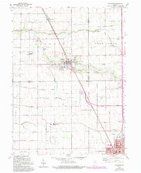
1959 Map of Galveston
USGS Topo · Published 1994About this map
The Pennsylvania RR corridor serves as the spine for this central Indiana landscape, connecting the agricultural trade hubs of Lincoln and Galveston. This mid-century survey reveals a transition from traditional township life to modern institutional development, marked by the arrival of the Northwestern High Sch and the northern reaches of Kokomo appearing near the southern border. The intricate drainage network of the Wabash River basin is highly visible, characterized by numerous family-named landmarks such as the Charles Templeton Ditch, Mathias Young Ditch, and Sarah-Hollipeter Ditch, which suggest a long history of land reclamation and community labor. In the northern sections, local genealogy is preserved through small rural burial grounds like Sprinkle Cem and Deer Creek Cem, while Grissom Air Force Base introduces a significant military presence just west of the railroad line.
Find a feature on this map
50 named features on this map. Tap any name to fly to it.
Don’t see what you’re looking for? This feature index may not catch every label — zoom into the map to look around manually.
Map Details
Editions of this 1959 Galveston Map
3 editions found
Other maps of this area

1951 · Onward
USGS Topo · 1:24,000

1951 · Bunker Hill
USGS Topo · 1:24,000

1953 · Danville
USGS Topo · 1:250,000

1955 · Danville
USGS Topo · 1:250,000

1955 · Anoka
USGS Topo · 1:24,000

1956 · Danville
USGS Topo · 1:250,000

1959 · Galveston
USGS Topo · 1:24,000

1959 · Miami
USGS Topo · 1:24,000

1959 · Young America
USGS Topo · 1:24,000

1960 · Kokomo West
USGS Topo · 1:24,000