Old Maps of Howard County, Indiana
Explore 95 old maps of Howard County, spanning from 1953 to today. These high-resolution historic maps reveal how streets, neighborhoods, landmarks, and natural features evolved over time — perfect for genealogy, metal detecting, research, and local history exploration.
What you can do with these maps:
- See how Howard County changed over time: Compare historical maps to modern-day views to trace roads, homesites, rail lines & more.
- View detailed metadata: Each map includes creators, publishers, year, scale, and archive source.
- Overlay maps with satellite & LiDAR: Visualize the past alongside modern tools to explore terrain & human change.
- Trusted historical sources: Maps sourced from the USGS, Library of Congress, and other archives.
- Access maps your way: View online, download high-res files, or order prints for personal or research use.
Start exploring old maps of Howard County to uncover forgotten places, hidden landmarks, and the deep history beneath your feet.
Howard County, IN maps
(95)- 1953 Map of Danville, 1965 Print
 1953 Danville1965 Print · USGSIndiana and Illinois crossroads come to life in this mid-century survey as the interstate era begins to reshape the river-and-rail landscape. Genealogists and collectors can trace the historic paths of the Nickel Plate railroad or locate smaller communities like Veedersburg, Goodland, and Bismarck.3 unique versions available
 - 1953 Map of Muncie, 1966 Print
 1953 Muncie1966 Print · USGSIndiana and Ohio borderlands thrive in the early fifties, showing a landscape defined by manufacturing cities and an intensive railroad network. Genealogists can trace family roots across the Indiana-Ohio line through Muncie, Celina, and Portland via the Pennsylvania railroad.5 unique versions available
 - 1955 Map of Danville
 1955 Danville1955 Print · USGSThe Indiana-Illinois borderlands during the mid-fifties reveal a landscape of thriving rail hubs and university towns. Researchers can trace the legacy of Purdue University, the Tippecanoe Battlefield, and the path of the Pennsylvania RR.
 - 1956 Map of Muncie
 1956 Muncie1956 Print · USGSEastern Indiana and western Ohio are shown at a peak of rail-driven industry in the mid-fifties. Genealogists and rail historians can trace the paths of the Pennsylvania RR through Muncie or locate landmarks like Lake Saint Marys (Grand Lake Reservoir) and Frances Slocum State Forest.
 - 1956 Map of Danville
 1956 Danville1956 Print · USGSMid-century Indiana and Illinois are captured here as the river-and-rail economy evolved into the modern highway era. Researchers can trace ancestral roots and old transport lines through Logansport, Battle Ground, and the dams at Lake Shafer.
 - 1959 Map of Galveston, 1960 Print
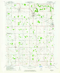
 1959 Galveston1960 Print · USGSGalveston and northern Howard County appear here in the late fifties, showcasing a landscape of railway-connected villages and tidy farm grids. Researchers can trace family history at Mt Zion Ch or locate old burial grounds like Sprinkle Cem and Rush Cem.3 unique versions available
 - 1959 Map of Miami, 1960 Print
 1959 Miami1960 Print · USGSThe borderlands of Miami and Howard County in the late fifties show a landscape of productive farm tracts and small rural hamlets. Researchers can trace family origins at Chitick Cemetery or Wawpecong, and follow the old Pennsylvania RR corridor.3 unique versions available
 - 1959 Map of Young America, 1961 Print
 1959 Young America1961 Print · USGSThe rural crossroads and fertile farmsteads of Howard and Cass Counties are captured here in the late 1950s. Local historians can trace family locations near Young America and Kappa Corner or locate vanished landmarks like the Galveston Airport and Ervin Sch.2 unique versions available
 - 1960 Map of Point Isabel, 1961 Print
 1960 Point Isabel1961 Print · USGSAgricultural life in central Indiana comes into focus during the early sixties, showing a landscape of small crossroads and family-named ditches. Genealogists can locate Antioch Ch, Knox Chapel, and the settlement of Point Isabel.4 unique versions available
 - 1960 Map of Kokomo West, 1961 Print
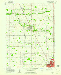
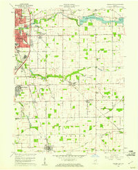
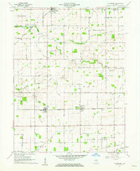
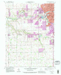
 1960 Kokomo West1961 Print · USGSThe western edge of Kokomo was undergoing steady post-war growth when this survey was conducted. Local researchers can trace family roots through landmarks like West Middleton, the Shiloh Church, and the New York Chicago and St Louis Railroad corridor.3 unique versions available
 - 1960 Map of Kokomo East, 1961 Print
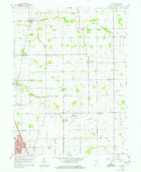
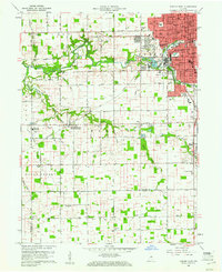
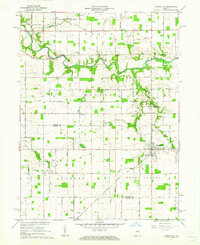
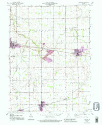
 1960 Kokomo East1961 Print · USGSThe Howard County countryside meets the rising industrial sprawl of Kokomo during the early sixties. Genealogists can trace family names and local landmarks through sites like Crown Point Cemetery, Darrough Chapel, and the rural Township Sch.3 unique versions available
 - 1960 Map of Kempton, 1961 Print
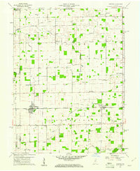 1960 Kempton1961 Print · USGSCentral Indiana's agricultural heartland is documented here in the early sixties, showing the vital rail-and-canal network. Trace family roots at Kempton Cem or explore the rural clusters of Groomsville and Normanda along the New York Chicago and St Louis railroad.2 unique versions available
 - 1960 Map of Greentown, 1961 Print
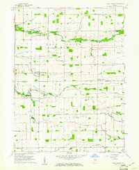
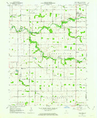
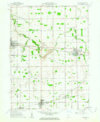
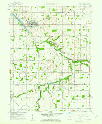 1960 Greentown1961 Print · USGSHoward County's agricultural heartland is documented here in the early sixties as the railroad era met a modernizing landscape. Trace the development of Greentown and smaller rural hamlets like Jerome and Phlox, alongside historic sites such as New Salem Ch and the Jerome Cem.4 unique versions available
 - 1961 Map of Russiaville, 1962 Print
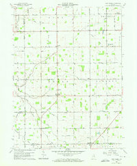
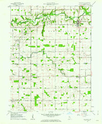
 1961 Russiaville1962 Print · USGSThe crossroads of Russiaville and the winding Wildcat Creek define this Howard County landscape in the early sixties. Genealogists can trace family roots through numerous sites like Old Prophet Cem, Howard Ch, and the settlement of New London.3 unique versions available
 - 1961 Map of Hillisburg, 1962 Print
 1961 Hillisburg1962 Print · USGSClinton and Howard counties show a landscape of rail-connected grain hubs and rural cemeteries in the early 1960s. Genealogists can locate family burial plots at Prairie Chapel Cem and Bacon Cem or trace the early paths of the St Louis and Chicago Road.2 unique versions available
 - 1961 Map of Burlington, 1962 Print
 1961 Burlington1962 Print · USGSCarroll and Clinton counties are captured here in the early sixties, showing a landscape defined by the winding Wildcat Creek and small rural intersections. Researchers can locate numerous historic burial grounds like Old Chaney Cem and Hye Park Cem or the rural Koro Church.3 unique versions available
 - 1962 Map of Deer Creek, 1963 Print
 1962 Deer Creek1963 Print · USGSCarroll County, Indiana, is captured here in the early 1960s as a thriving agricultural landscape defined by its namesake creek and local townships. Genealogists and local historians can locate specific landmarks like Paint Creek Ch, Hopewell Cem, and the community of Wheeling.
 - 1962 Map of Amboy, 1963 Print
 1962 Amboy1963 Print · USGSMiami and Howard counties appear here in the early sixties as a thriving rail-and-farming landscape. Genealogists and local historians can trace family-named sites like Herchberger Cem, visit North Grove Ch, or follow the Pennsylvania Railroad through Amboy.2 unique versions available
 - 1962 Map of Sweetser, 1963 Print
 1962 Sweetser1963 Print · USGSGrant County in the early sixties was a hub of rural industry and local rail transport. Genealogists and historians can trace family roots at Thrailkill Cemetery, explore the rail sidings of Swayzee, or locate the Richland Chapel and Oak Hill High School.
 - 1984 Map of Lafayette, 1985 Print
 1984 Lafayette1985 Print · USGSNorth-central Indiana thrives in the 1980s as a hub of higher education, industry, and agriculture centered on the Wabash River. Genealogists and historians can locate family sites near Darrough Chapel, Oak Hill Cem, or the small crossroads of Thorntown and Colfax.2 unique versions available
 - 1985 Map of Logansport
 1985 Logansport1985 Print · USGSNorth-central Indiana in the mid-eighties shows a landscape of river-fed towns and significant military aviation hubs. Genealogists and local historians can trace the rail corridors of the Conrail or locate sites like River View Cem and the crossroads at Twelve Mile.2 unique versions available
 - 1986 Map of Wabash
 1986 Wabash1986 Print · USGSThe Wabash Valley and surrounding Indiana farm country are captured here in the mid-eighties, showing a landscape reshaped by major reservoirs. Genealogists and local historians can trace the paths of the Old Indian Trail and the industrial reach of the Conrail line through towns like Lagro and Warren.2 unique versions available
 - 1986 Map of Muncie
 1986 Muncie1986 Print · USGSEast Central Indiana was a hub of manufacturing and higher education in the mid-eighties. Genealogists and historians can trace the streets of Muncie, locate rural Cem sites, and explore landmarks like Mounds State Park and Taylor Univ.3 unique versions available
 - 1992 Map of Kokomo West, 1995 Print
 1992 Kokomo West1995 Print · USGSHoward County's western outskirts and the growing city of Kokomo are captured here in the early nineties as suburban expansion met rural farmland. Researchers can trace local community roots through landmarks like West Middleton, Shiloh Ch, and the Western High Sch.
 - 1992 Map of Sweetser, 1995 Print
 1992 Sweetser1995 Print · USGSThe rural-industrial landscape of Grant and Miami counties is captured in the early nineties. Researchers can trace the Central Railroad of Indianapolis past Swayzee and locate sites like Thrailkill Cem and Sims.
Showing maps 1-25 of 95
Top cities of Howard County
Frequently asked questions
- What are the different types of historical maps available for Howard County?
- What is the oldest map of Howard County?
- Where can I purchase historical maps of Howard County for my home or office?
- Where can I download high-res historical maps of Howard County?
- Are there historical topographic maps available for Howard County?
- Is there historical aerial imagery available for Howard County?
- Where are historical maps of Howard County sourced from?