2024 Map of Gamaliel
USGS Topo · Published 2024About this map
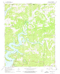
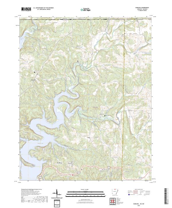
Norfork Lake dominates the southwestern landscape of this Baxter County region, where the reservoir waters fill deep hollows and surround prominent features like Bidwell Point. The settlement of Gamaliel sits nestled on the high ground between the lake and the winding path of Bennetts Bayou. Local genealogy is well-preserved through several established burial grounds, including the Gamaliel Cem, Fluty Cem, and Athens Cem. Further south, the community of Henderson serves as a lakeside anchor, while the small hamlet of Cumi remains further inland.
Find a feature on this map
93 named features on this map. Tap any name to fly to it.
Don’t see what you’re looking for? This feature index may not catch every label — zoom into the map to look around manually.
Map Details
Editions of this 2024 Gamaliel Map
This is the sole edition of this map. No revisions or reprints were ever made.
Historical Maps of County Line Through Time
3 maps found