1979 Map of Gamaliel
USGS Topo · Published 1981About this map
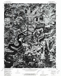
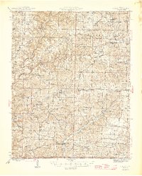
Norfork Lake dominates the center of this 1979 aerial orthophotoquad, showing the intricate, winding shoreline of the reservoir as it appeared decades ago. Produced in cooperation with the Soil Conservation Service, the imagery captures the landscape in Baxter County, Arkansas, and extends across the border into Missouri. The settlement of Gamaliel is visible in the northwestern portion of the map, situated amidst a pattern of forested ridges and cleared agricultural plots. Further south, the map identifies the small community of Cumi near the rugged eastern arm of the lake. This specialized photograph-based map provides a realistic view of land use and vegetation patterns along the Bennetts River and its tributaries, reflecting the development of this Ozark region after the creation of the reservoir.
Find a feature on this map
4 named features on this map. Tap any name to fly to it.
Don’t see what you’re looking for? This feature index may not catch every label — zoom into the map to look around manually.
Map Details
Editions of this 1979 Gamaliel Map
This is the sole edition of this map. No revisions or reprints were ever made.
Other maps of this area

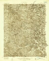
1890 · Mountain Home
USGS Topo · 1:125,000

1891 · Mountain Home
USGS Topo · 1:125,000

1894 · Mountain Home
USGS Topo · 1:125,000
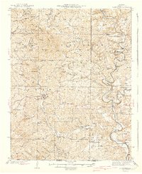
1934 · Gainesville
USGS Topo · 1:48,000
1940 · Gainesville
USGS Topo · 1:62,500
1944 · Cureall
USGS Topo · 1:62,500

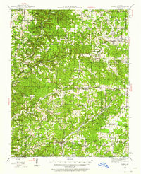
1945 · Harrison
USGS Topo · 1:250,000
1946 · Cureall
USGS Topo · 1:62,500

1949 · Harrison
USGS Topo · 1:250,000

1954 · Harrison
USGS Topo · 1:250,000