
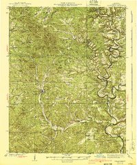
1940 Map of Gainesville
USGS Topo · Published 1940About this map
Gainesville serves as the focal point of this Ozark County landscape, where the topography is defined by an intricate network of ridges and deep hollows. The river system of Bryant Creek and the North Fork Bryant Creek dominates the eastern half of the map, featuring numerous river crossings such as Osborn Ford and Poe Ford that were vital for local travel before modern bridging.
Find a feature on this map
107 named features on this map. Tap any name to fly to it.
Don’t see what you’re looking for? This feature index may not catch every label — zoom into the map to look around manually.
Map Details
Editions of this 1940 Gainesville Map
2 editions found
Other maps of this area

1890 · Mountain Home
USGS Topo · 1:125,000

1891 · Mountain Home
USGS Topo · 1:125,000

1893 · Yellville
USGS Topo · 1:125,000

1894 · Mountain Home
USGS Topo · 1:125,000

1903 · Yellville
USGS Topo · 1:125,000

1905 · Yellville
USGS Topo · 1:125,000

1929 · Yellville
USGS Topo · 1:125,000

1934 · Gainesville
USGS Topo · 1:48,000

1936 · Thornfield
USGS Topo · 1:48,000

1936 · Ava
USGS Topo · 1:48,000