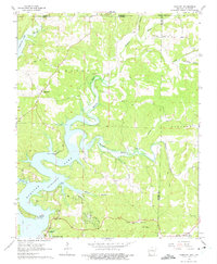
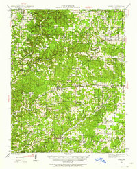
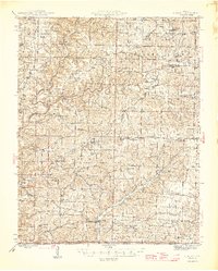
1965 Map of Gamaliel
USGS Topo · Published 1975About this map
Gamaliel stands as the primary settlement in this mid-1960s survey of the Ozark borderlands, situated just south of the Missouri-Arkansas state line. The landscape is defined by the winding reaches of Norfork Lake, where inundation patterns affect the drainage of Bennetts Bayou and Bennetts River. The map provides a clear look at rural life before extensive modern development, documenting small communities like Cumi and Henderson alongside a network of country churches and cemeteries that anchor the local genealogy.
Find a feature on this map
34 named features on this map. Tap any name to fly to it.
Don’t see what you’re looking for? This feature index may not catch every label — zoom into the map to look around manually.
Map Details
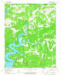
Editions of this 1965 Gamaliel Map
2 editions found
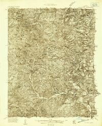
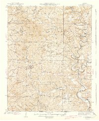
Other maps of this area

1890 · Mountain Home
USGS Topo · 1:125,000

1891 · Mountain Home
USGS Topo · 1:125,000

1894 · Mountain Home
USGS Topo · 1:125,000
1934 · Gainesville
USGS Topo · 1:48,000
1940 · Gainesville
USGS Topo · 1:62,500
1944 · Cureall
USGS Topo · 1:62,500

1945 · Harrison
USGS Topo · 1:250,000
1946 · Cureall
USGS Topo · 1:62,500

1949 · Harrison
USGS Topo · 1:250,000

1954 · Harrison
USGS Topo · 1:250,000