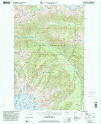
1999 Map of Gamma Peak
USGS Topo · Published 2002About this map
Gamma Hot Springs lies at the heart of this high-alpine landscape within the Glacier Peak Wilderness, where geothermal activity meets glacial ice. The survey documents the drainage systems of the Suiattle River, fed by an array of ice fields including the Ptarmigan Glacier, Kennedy Glacier, and Dusty Glacier. High-altitude features like Gamma Peak and Kennedy Peak dominate the southern reach, while the north is defined by the steep corridors of Bath Creek and Canyon Creek. Human passage through this environment is primarily represented by the Pacific Crest National Scenic Trail, which winds across Miners Ridge near Image Lake. The map details a complex network of ridges, including Vista Ridge and Middle Ridge, which illustrate the extreme topography that has limited permanent development in this portion of the Mt Baker - Snoqualmie National Forest.
Find a feature on this map
33 named features on this map. Tap any name to fly to it.
Don’t see what you’re looking for? This feature index may not catch every label — zoom into the map to look around manually.
Map Details
Editions of this 1999 Gamma Peak Map
This is the sole edition of this map. No revisions or reprints were ever made.
Other maps of this area

1899 · Glacier Peak
USGS Topo · 1:125,000

1901 · Glacier Peak
USGS Topo · 1:125,000

1902 · Stehekin
USGS Topo · 1:125,000

1904 · Stehekin
USGS Topo · 1:125,000

1944 · Holden
USGS Topo · 1:62,500

1949 · Holden
USGS Topo · 1:62,500

1950 · Glacier Peak
USGS Topo · 1:62,500

1955 · Concrete
USGS Topo · 1:250,000

1958 · Concrete
USGS Topo · 1:250,000

1962 · Concrete
USGS Topo · 1:250,000