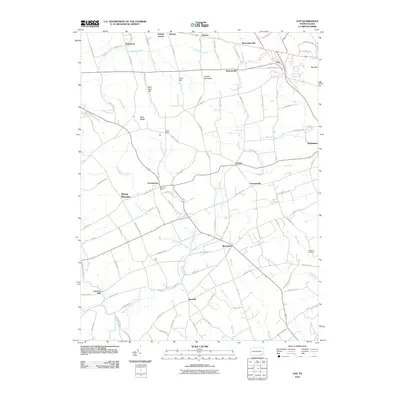
2010 Map of Gap
USGS Topo · Published 2010About this map
Mine Ridge and Gap Hill define the northern terrain of this Lancaster County landscape, where the settlements of Gap and Christiana anchor an area deeply rooted in early Pennsylvania industry and transit. The map traces the historical intersection of commerce and geography, most notably at Nickel Mines, situated along the appropriately named Nickel Mines Run. The surrounding countryside is dotted with small crossroads communities like Ninepoints, Smyrna, and Bartville, which supported the agrarian and mining economy of the region.
Find a feature on this map
99 named features on this map. Tap any name to fly to it.
Don’t see what you’re looking for? This feature index may not catch every label — zoom into the map to look around manually.
Map Details
Editions of this 2010 Gap Map
This is the sole edition of this map. No revisions or reprints were ever made.
Other maps of this area

1904 · Coatesville
USGS Topo · 1:62,500

1905 · Honey Brook
USGS Topo · 1:62,500

1906 · Coatesville
USGS Topo · 1:62,500

1906 · New Holland
USGS Topo · 1:62,500

1907 · Honeybrook
USGS Topo · 1:62,500

1908 · New Holland
USGS Topo · 1:62,500

1912 · Quarryville
USGS Topo · 1:62,500

1918 · Coatesville
USGS Topo · 1:62,500

1941 · Honeybrook
USGS Topo · 1:62,500

1941 · New Holland
USGS Topo · 1:62,500
Featured Places
- Paradise Township, PA
- Bart Township, PA
- Sadsbury Township, PA
- Ninepoints, Bart Township
- Smyrna, Sadsbury Township