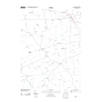
2013 Map of Gap
USGS Topo · Published 2013About this map
Mine Ridge and Gap Hill form a prominent topographical spine across this part of Lancaster County, defining the local drainages and settlement patterns of the early 21st century. The legacy of extraction is evident in the hamlet of Nickel Mines and the nearby Nickel Mines Run, while agricultural and milling history is preserved at Conners Mill on the Bowery Run. The area is a network of small crossroads communities such as Slaymakersville, Kinzers, and Ninepoints, connected by a dense grid of rural routes including Old Strasburg Rd and Newport Pike. To the south, the landscape opens into the Linville Hill Valley, where the West Br Octoraro Cr and its tributaries like Ball Run and Bells Run carve through the countryside, illustrating the enduring relationship between the region's complex geology and its water-powered past.
Find a feature on this map
130 named features on this map. Tap any name to fly to it.
Don’t see what you’re looking for? This feature index may not catch every label — zoom into the map to look around manually.
Map Details
Editions of this 2013 Gap Map
This is the sole edition of this map. No revisions or reprints were ever made.
Other maps of this area

1904 · Coatesville
USGS Topo · 1:62,500

1905 · Honey Brook
USGS Topo · 1:62,500

1906 · Coatesville
USGS Topo · 1:62,500

1906 · New Holland
USGS Topo · 1:62,500

1907 · Honeybrook
USGS Topo · 1:62,500

1908 · New Holland
USGS Topo · 1:62,500

1912 · Quarryville
USGS Topo · 1:62,500

1918 · Coatesville
USGS Topo · 1:62,500

1941 · Honeybrook
USGS Topo · 1:62,500

1941 · New Holland
USGS Topo · 1:62,500
Featured Places
- Paradise Township, PA
- Bart Township, PA
- Sadsbury Township, PA
- Ninepoints, Bart Township
- Smyrna, Sadsbury Township