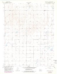
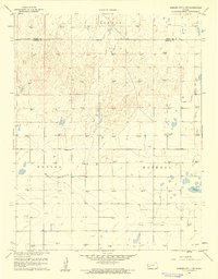
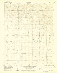
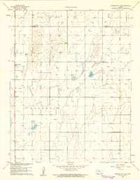
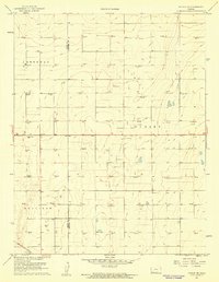
1959 Map of Garden City 3 NW
USGS Topo · Published 1978About this map
Haskell Co and Finney Co meet in this landscape of southwestern Kansas, where the High Plains are defined by an intensive subterranean economy. The survey reveals a dense network of energy extraction across Ivanhoe, Dudley, and Haskell townships, evidenced by dozens of Gas Wells and the occasional Oli Well. These individual wells are connected by a web of light-duty and unimproved roads that cut across the section lines of the rural grid. While the industrial footprint is pervasive, evidence of community life remains at Valley Sch, a local landmark for families in this corner of the county. The topography is subtle, characterized by the gentle depressions and rises typical of this prairie region, with elevations meticulously recorded through numerous bench marks and spot elevations across the terrain.
Find a feature on this map
7 named features on this map. Tap any name to fly to it.
Don’t see what you’re looking for? This feature index may not catch every label — zoom into the map to look around manually.
Map Details
Editions of this 1959 Garden City 3 NW Map
3 editions found
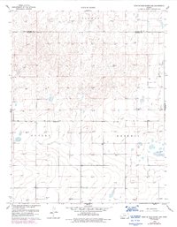
Other maps of this area

1891 · Larned
USGS Topo · 1:125,000
1896 · Garden
USGS Topo · 1:125,000
1900 · Lakin
USGS Topo · 1:125,000

1955 · Dodge City
USGS Topo · 1:250,000

1958 · Dodge City
USGS Topo · 1:250,000

1959 · Dodge City
USGS Topo · 1:250,000
1959 · Garden City 3 NW
USGS Topo · 1:24,000
1959 · Hickok NE
USGS Topo · 1:24,000
1959 · Garden City 3 NE
USGS Topo · 1:24,000
1960 · Hickok SE
USGS Topo · 1:24,000