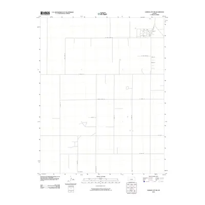
2009 Map of Garden City SW
USGS Topo · Published 2009About this map
Plymell Church Rd serves as a central east-west axis for this southwestern Kansas landscape, reflecting the rural grid system that defines Finney County. The area is characterized by vast agricultural sections partitioned by a network of long, straight roads often named for local figures or families, such as W Annie Scheer Rd, W Pete Smith Rd, and Annie Scheer Rd. Small residential clusters appear in the northeast, notably along Osage Ct and Maize Ct, contrasting with the expansive open fields to the south.
Find a feature on this map
19 named features on this map. Tap any name to fly to it.
Don’t see what you’re looking for? This feature index may not catch every label — zoom into the map to look around manually.
Map Details
Editions of this 2009 Garden City SW Map
This is the sole edition of this map. No revisions or reprints were ever made.
Other maps of this area
1891 · Larned
USGS Topo · 1:125,000
1896 · Garden
USGS Topo · 1:125,000
1900 · Lakin
USGS Topo · 1:125,000
1955 · Dodge City
USGS Topo · 1:250,000
1958 · Dodge City
USGS Topo · 1:250,000
1959 · Dodge City
USGS Topo · 1:250,000
1959 · Garden City 3 NW
USGS Topo · 1:24,000
1959 · Hickok NE
USGS Topo · 1:24,000
1959 · Garden City 3 NE
USGS Topo · 1:24,000
1960 · Garden City East
USGS Topo · 1:24,000