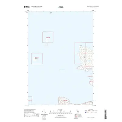
2019 Map of Garden Island West
USGS Topo · Published 2019About this map
Garden Island and the northern tip of Beaver Island dominate this coastal survey of the Beaver Archipelago in northern Lake Michigan. This 2019 data captures the isolated geography of the islands, including smaller landmasses like Squaw Island and Whiskey Island. On the southern edge of the map, the tip of Beaver Island shows a cluster of development near Lookout Point, where local roads like Lake Dr and Beaver Dr provide access to the shoreline. The northern reach of the island is home to the Saint James Township Cem, a significant site for local genealogy and history.
Find a feature on this map
27 named features on this map. Tap any name to fly to it.
Don’t see what you’re looking for? This feature index may not catch every label — zoom into the map to look around manually.
Map Details
Editions of this 2019 Garden Island West Map
This is the sole edition of this map. No revisions or reprints were ever made.
Other maps of this area

1955 · Hog Island
USGS Topo · 1:62,500

1955 · Cheboygan
USGS Topo · 1:250,000

1956 · Beaver Island
USGS Topo · 1:62,500

1958 · Cheboygan
USGS Topo · 1:250,000
1973 · Point Patterson
USGS Topo · 1:24,000
1980 · Garden Island West
USGS Topo · 1:24,000

1984 · Beaver Island
USGS Topo · 1:100,000

1986 · High Island
USGS Topo · 1:24,000

1986 · Beaver Island North
USGS Topo · 1:24,000
1986 · Hog Island West
USGS Topo · 1:24,000