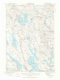
1941 Map of Gardner Lake
USGS Topo · Published 1966About this map
Cathance Lake and Gardner Lake dominate this 1941 landscape, a region defined by complex water systems and small, dispersed settlements during the early 1940s. The survey reveals a network of rural schoolhouses serving isolated communities, including the East Ridge Sch, West Ridge Sch, and the Hadley Lake Sch near the southern edge. The rugged glacial topography is marked by named heights like Cooper Hill, which features a Firetower, and Porcupine Mtn overlooking the Marion area.
Find a feature on this map
107 named features on this map. Tap any name to fly to it.
Don’t see what you’re looking for? This feature index may not catch every label — zoom into the map to look around manually.
Map Details
Editions of this 1941 Gardner Lake Map
3 editions found

Other maps of this area

1907 · Eastport
USGS Topo · 1:48,000

1908 · Eastport
USGS Topo · 1:62,500

1917 · Cutler
USGS Topo · 1:62,500

1918 · Machias
USGS Topo · 1:62,500

1918 · Cutler
USGS Topo · 1:62,500

1921 · Columbia Falls
USGS Topo · 1:62,500

1929 · Calais
USGS Topo · 1:48,000

1929 · Robbinston
USGS Topo · 1:48,000

1931 · Robbinston
USGS Topo · 1:62,500

1932 · Calais
USGS Topo · 1:62,500