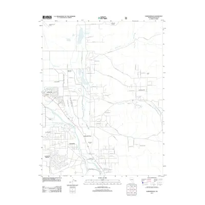
2012 Map of Gardnerville
USGS Topo · Published 2012About this map
Carson Valley serves as a lush corridor for agriculture and settlement in this western Nevada landscape. The East Fork Carson River dictates the region's layout, supported by an intricate network of irrigation including the Allerman Canal, Old Virginia Canal, and Edna Wilslef Ditch. These waterways sustain numerous family-named landmarks like the Springmeyer Ranch and Settlemeyer Ranch, reflecting a long-standing ranching tradition. The map highlights the community of Dresslerville and the Washoe Tribe Campground, signifying the indigenous heritage of the area. Further south, the Lahontan National Fish Hatchery sits near Indian Creek, while the expansive Gardnerville Ranchos indicates modern residential growth. From the industrial aviation presence at Pinenut Airport to the historic Twelvemile House, this survey provides a comprehensive look at the intersection of water rights and local land use.
Find a feature on this map
118 named features on this map. Tap any name to fly to it.
Don’t see what you’re looking for? This feature index may not catch every label — zoom into the map to look around manually.
Map Details
Editions of this 2012 Gardnerville Map
This is the sole edition of this map. No revisions or reprints were ever made.
Other maps of this area

1889 · Markleeville
USGS Topo · 1:125,000

1891 · Carson
USGS Topo · 1:125,000

1891 · Markleeville
USGS Topo · 1:125,000

1893 · Carson
USGS Topo · 1:125,000

1893 · Markleeville
USGS Topo · 1:125,000

1948 · Walker Lake
USGS Topo · 1:250,000

1956 · Freel Peak
USGS Topo · 1:62,500

1956 · Dayton
USGS Topo · 1:62,500

1956 · Carson City
USGS Topo · 1:62,500

1957 · Walker Lake
USGS Topo · 1:250,000