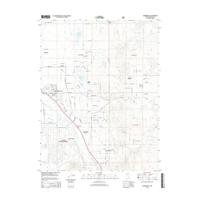
2014 Map of Gardnerville
USGS Topo · Published 2014About this map
Gardnerville and its neighbor Minden serve as the focal points of this Nevada landscape, where the valley floor is defined by a complex irrigation network and the transition to the high desert. The East Fork Carson River and its various sloughs, including Martin Slough and Cottonwood Slough, are harnessed by an intricate system of waterways like the Lower Old Virginia Canal and Allerman Canal. These features reflect the region's long-standing reliance on water management for agriculture and settlement. Farther south, the community of Dresslerville and the landmark Twelvemile House stand near the edge of the Toiyabe National Forest, while the terrain to the east rises into Williams Canyon. The map reveals the expansion of residential roads in East Valley and Ruhenstroth, contrasted against large-scale water features such as Dangberg Reservoir Number Four.
Find a feature on this map
117 named features on this map. Tap any name to fly to it.
Don’t see what you’re looking for? This feature index may not catch every label — zoom into the map to look around manually.
Map Details
Editions of this 2014 Gardnerville Map
This is the sole edition of this map. No revisions or reprints were ever made.
Other maps of this area

1889 · Markleeville
USGS Topo · 1:125,000

1891 · Carson
USGS Topo · 1:125,000

1891 · Markleeville
USGS Topo · 1:125,000

1893 · Carson
USGS Topo · 1:125,000

1893 · Markleeville
USGS Topo · 1:125,000

1948 · Walker Lake
USGS Topo · 1:250,000

1956 · Freel Peak
USGS Topo · 1:62,500

1956 · Dayton
USGS Topo · 1:62,500

1956 · Carson City
USGS Topo · 1:62,500

1957 · Walker Lake
USGS Topo · 1:250,000