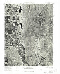
1974 Map of Gardnerville
USGS Topo · Published 1977About this map
Gardnerville serves as the focal point of this 1974 orthophotoquad, where residential blocks and agricultural fields meet the high-desert terrain of the Carson Valley. The aerial imagery captures the distinct contrast between the irrigated greenery along the Carson River and the arid eastern landscape of Fish Spring Flat. This specific visual record, based on photographs taken on Independence Day, preserves the town's footprint before the significant modern expansion of the late 20th century.
Find a feature on this map
5 named features on this map. Tap any name to fly to it.
Don’t see what you’re looking for? This feature index may not catch every label — zoom into the map to look around manually.
Map Details
Editions of this 1974 Gardnerville Map
This is the sole edition of this map. No revisions or reprints were ever made.
Other maps of this area

1889 · Markleeville
USGS Topo · 1:125,000

1891 · Carson
USGS Topo · 1:125,000

1891 · Markleeville
USGS Topo · 1:125,000

1893 · Carson
USGS Topo · 1:125,000

1893 · Markleeville
USGS Topo · 1:125,000

1948 · Walker Lake
USGS Topo · 1:250,000

1956 · Freel Peak
USGS Topo · 1:62,500

1956 · Dayton
USGS Topo · 1:62,500
1956 · Carson City
USGS Topo · 1:62,500

1957 · Walker Lake
USGS Topo · 1:250,000