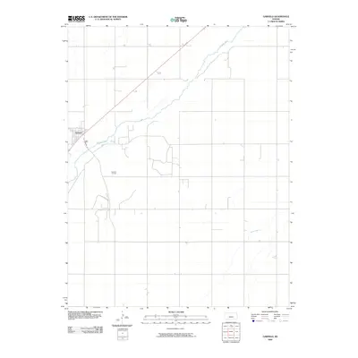
2009 Map of Garfield
USGS Topo · Published 2009About this map
Garfield sits within a landscape defined by the winding course of the Arkansas River in western Kansas. This survey illustrates the town's grid and its relationship to the surrounding agricultural and energy infrastructure, notably the Garfield Oil Field situated to the south. The terrain is relatively flat, drained by smaller seasonal waterways like Pickle Creek as they move toward the larger river basin. While the town center is clustered near Pawnee St, the map reflects the broader rural organization of Pawnee County, where section lines dictate the road network and land use. The presence of active oil extraction alongside the river system highlights the dual economic reliance on natural resources and prairie cultivation that has sustained this community for generations.
Find a feature on this map
5 named features on this map. Tap any name to fly to it.
Don’t see what you’re looking for? This feature index may not catch every label — zoom into the map to look around manually.
Map Details
Editions of this 2009 Garfield Map
This is the sole edition of this map. No revisions or reprints were ever made.
Other maps of this area

1889 · Larned
USGS Topo · 1:125,000

1889 · Kinsley
USGS Topo · 1:125,000

1891 · Larned
USGS Topo · 1:125,000

1892 · Kinsley
USGS Topo · 1:125,000

1894 · Kinsley
USGS Topo · 1:125,000

1955 · Great Bend
USGS Topo · 1:250,000

1955 · Pratt
USGS Topo · 1:250,000

1957 · Great Bend
USGS Topo · 1:250,000

1958 · Great Bend
USGS Topo · 1:250,000

1959 · Pratt
USGS Topo · 1:250,000