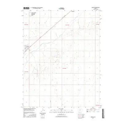
2015 Map of Garfield
USGS Topo · Published 2015About this map
Fort Larned National Historic Site stands at the northwestern corner of this landscape, preserving a critical piece of frontier history along the old Santa Fe Trail corridor. The town of Garfield occupies a strategic bend where Coon Cr meets the Arkansas River, showing a grid of local streets including School St and Pawnee St that reflect its civic development. Modern infrastructure follows historical paths here, with Ne Trail St cutting diagonally across the township lines of the Great Plains. The surrounding terrain is defined by the broad river valley and its tributaries like Pickle Cr, while the small settlement of Hamburg sits further northeast along the river's edge. This 2015 survey illustrates how traditional section-line roads such as 180th Ave and D Rd continue to organize the agricultural character of Pawnee County.
Find a feature on this map
26 named features on this map. Tap any name to fly to it.
Don’t see what you’re looking for? This feature index may not catch every label — zoom into the map to look around manually.
Map Details
Editions of this 2015 Garfield Map
This is the sole edition of this map. No revisions or reprints were ever made.
Other maps of this area

1889 · Larned
USGS Topo · 1:125,000

1889 · Kinsley
USGS Topo · 1:125,000

1891 · Larned
USGS Topo · 1:125,000

1892 · Kinsley
USGS Topo · 1:125,000

1894 · Kinsley
USGS Topo · 1:125,000

1955 · Great Bend
USGS Topo · 1:250,000

1955 · Pratt
USGS Topo · 1:250,000

1957 · Great Bend
USGS Topo · 1:250,000

1958 · Great Bend
USGS Topo · 1:250,000

1959 · Pratt
USGS Topo · 1:250,000