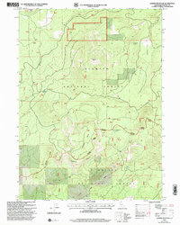
2001 Map of Garner Mountain
USGS Topo · Published 2004About this map
Klamath National Forest and Shasta National Forest dominate this Siskiyou County landscape, where the volcanic topography of the southern Cascades is defined by prominent peaks and ridges. The terrain rises sharply to Garner Mtn and Garner Butte, giving way to the expansive level ground of Tamarack Flat. This high-elevation wilderness is networked with forest roads, including the Goosenest Mc Cloud route, which provides access to remote hydrologic features like Baird Spring and Tamarack Lake.
Find a feature on this map
20 named features on this map. Tap any name to fly to it.
Don’t see what you’re looking for? This feature index may not catch every label — zoom into the map to look around manually.
Map Details
Editions of this 2001 Garner Mountain Map
This is the sole edition of this map. No revisions or reprints were ever made.
Other maps of this area

1886 · Modoc Lava Bed
USGS Topo · 1:250,000

1892 · Modoc Lava-Bed
USGS Topo · 1:250,000

1932 · Bartle
USGS Topo · 1:96,000

1939 · Bartle
USGS Topo · 1:125,000

1950 · Bray
USGS Topo · 1:62,500

1952 · Medicine Lake
USGS Topo · 1:62,500

1954 · Alturas
USGS Topo · 1:250,000

1958 · Alturas
USGS Topo · 1:250,000

1961 · Hambone
USGS Topo · 1:62,500

1961 · Bartle
USGS Topo · 1:62,500