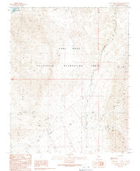
1989 Map of Garnet Mountain NW
USGS Topo · Published 1990About this map
The White Hills of Mohave County define this desert landscape, where mineral exploration and protected federal lands meet. Much of the northern terrain is managed as the Lake Mead National Recreation Area, including the shoreline of Salt Spring Bay. The map is particularly notable for its dense concentrations of mining activity, featuring named operations such as the Golden Mile Mine, Bluebird Mine, and Gold Hill Mine. Dozens of individual Prospects, Adits, and Mine Shafts are marked across the ridges, providing a clear record of the area's geological prospecting history. Drainage for the region is shaped by the broad Hualapai Wash and the distinctively named White Elephant Wash, which cut through the arid topography toward the reservoir.
Find a feature on this map
19 named features on this map. Tap any name to fly to it.
Don’t see what you’re looking for? This feature index may not catch every label — zoom into the map to look around manually.
Map Details
Editions of this 1989 Garnet Mountain NW Map
This is the sole edition of this map. No revisions or reprints were ever made.
Other maps of this area

1886 · Camp Mohave
USGS Topo · 1:250,000

1886 · Saint Thomas
USGS Topo · 1:250,000

1892 · Camp Mohave
USGS Topo · 1:250,000

1893 · Saint Thomas
USGS Topo · 1:250,000

1926 · Bonelli
USGS Topo · 1:96,000

1942 · Camp Mohave
USGS Topo · 1:250,000

1947 · Kingman
USGS Topo · 1:250,000

1948 · Kingman
USGS Topo · 1:250,000

1953 · Iceberg Canyon
USGS Topo · 1:62,500

1953 · Virgin Basin
USGS Topo · 1:62,500